Our heritage
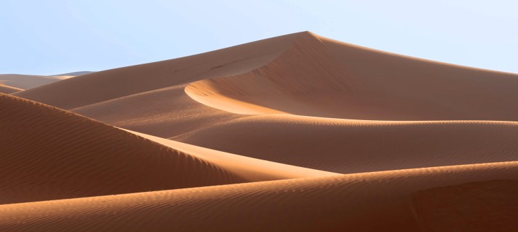
Welcome to Dubai Desert Conservation Reserve

Experience DDCR
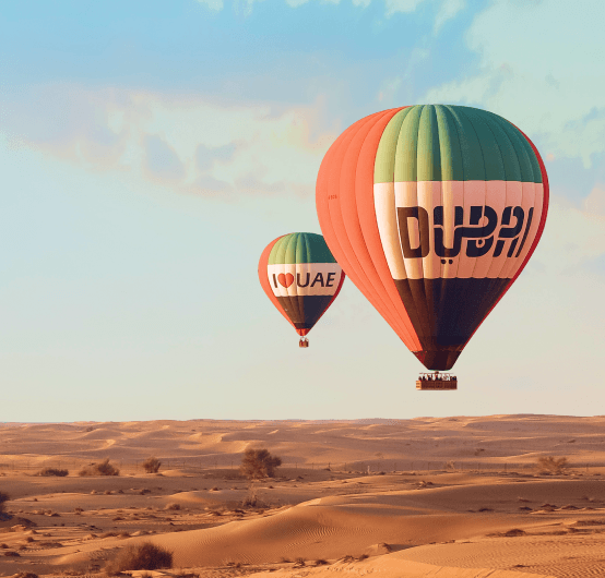
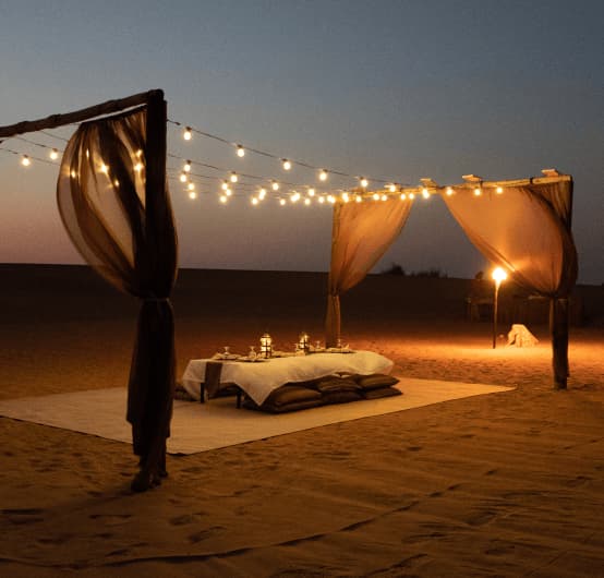
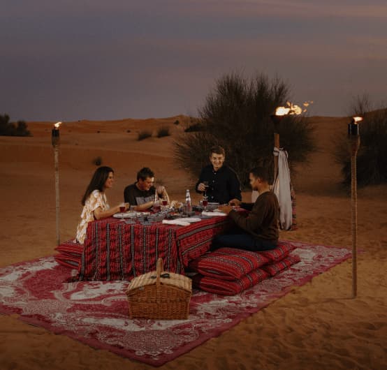
Try your hand at falconry, ride a camel or simply hike through our unique desert surroundings

Learn more when you visit
Drop by our visitor centre to learn more about DDCR, our history, resident species and more
ABOUT DDCR
At Dubai Desert Conservation Reserve, we work to protect Dubai's last desert wilderness and its native plants and animals.
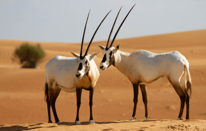
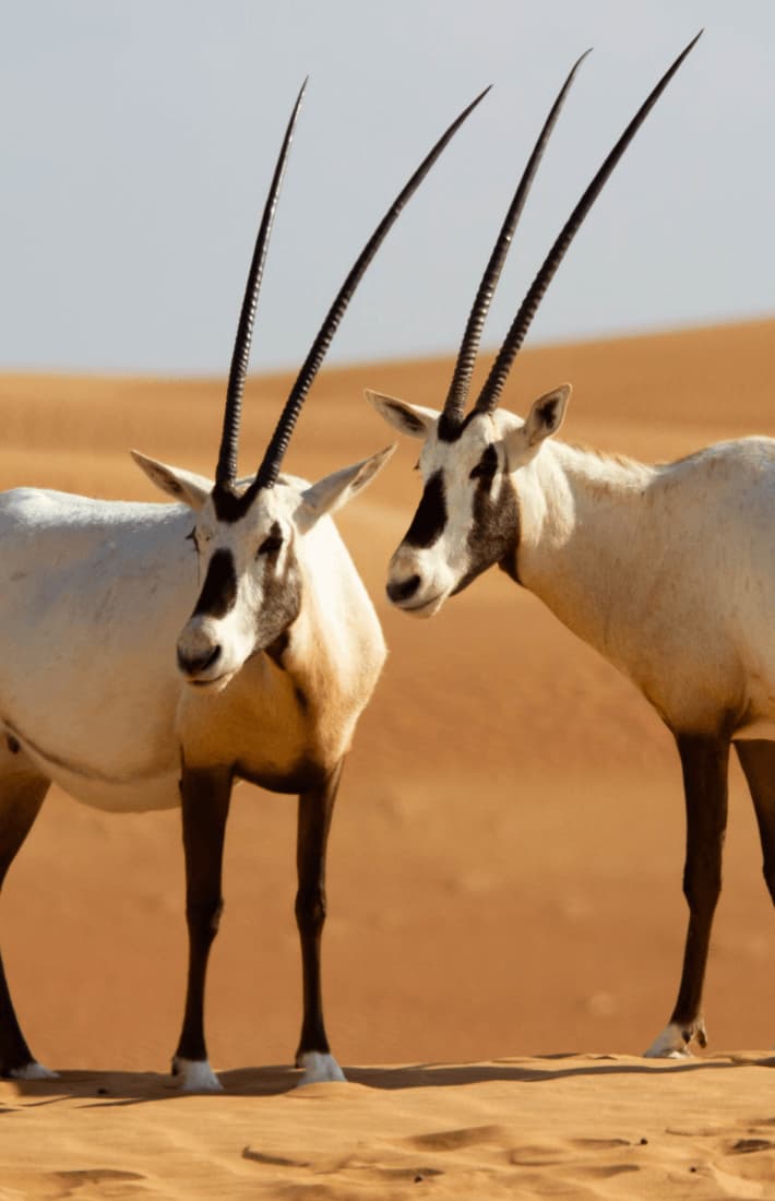
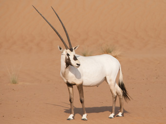
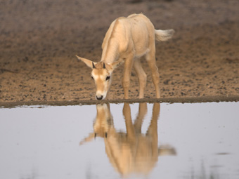
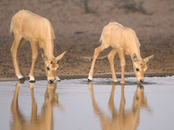
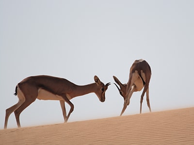
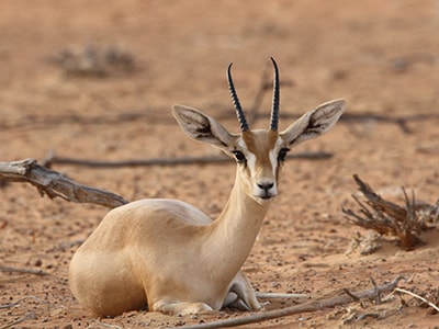
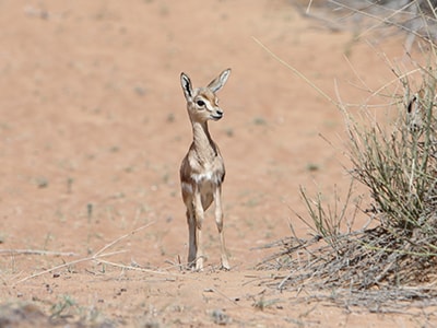
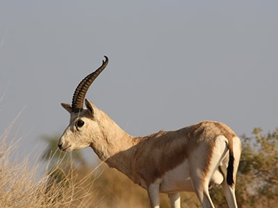
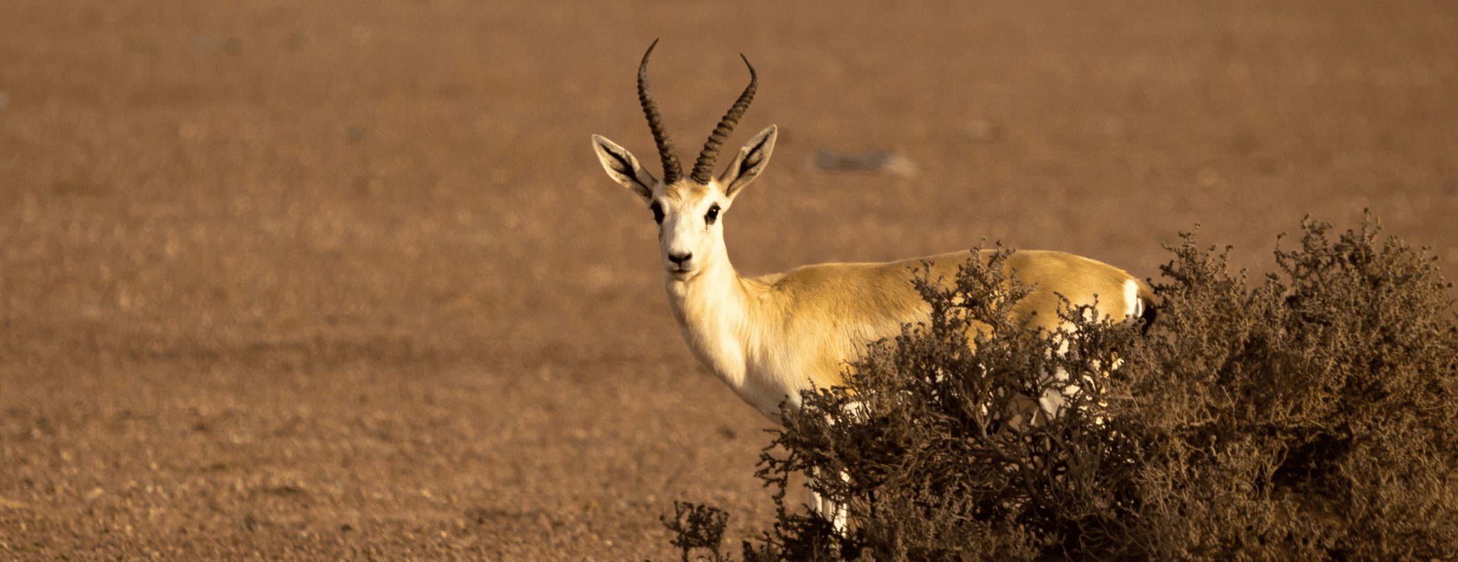
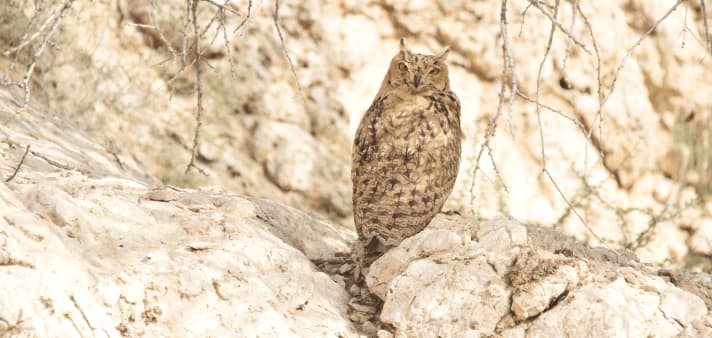
THE CHARISMATIC TEN
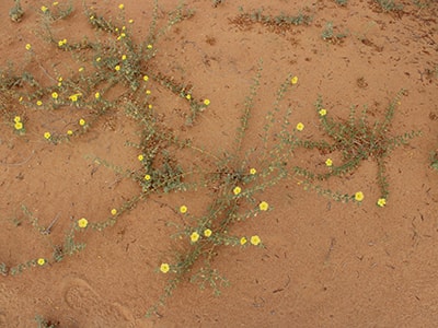
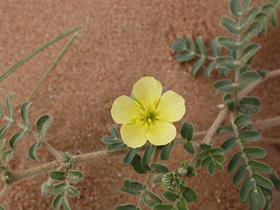
The desert is teeming with life, and you’ll be amazed by how plants and animals have adapted to living in what can be a harsh environment at times.
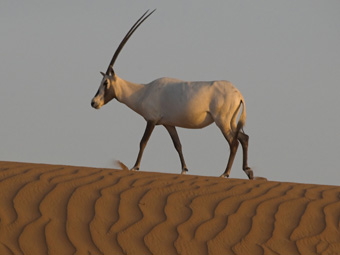
Arabian Oryx
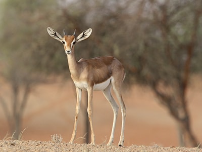
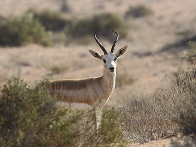
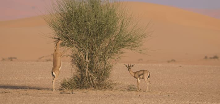
Arabian Gazelle
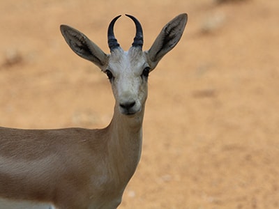
Sand Gazelle
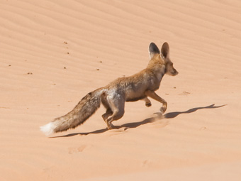
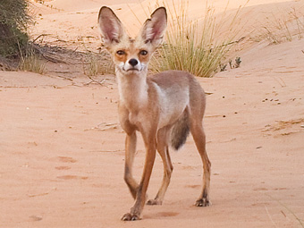
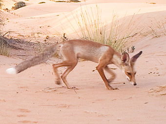
Arabian Red Fox
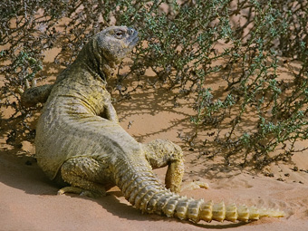
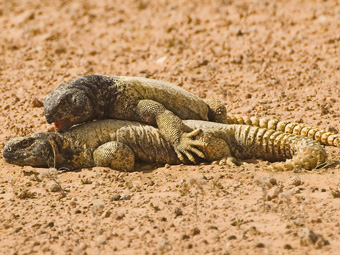
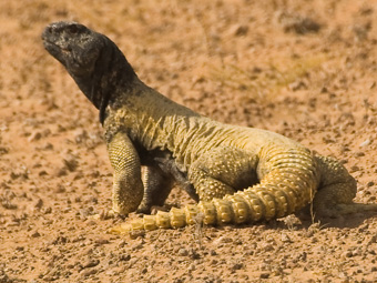
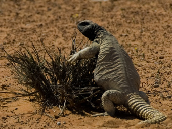
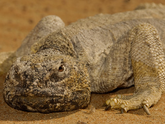
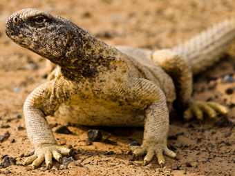
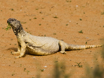
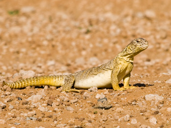
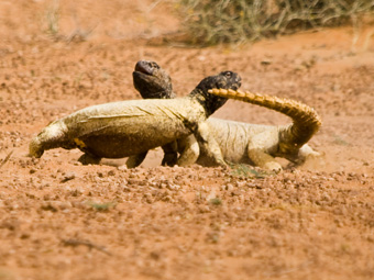
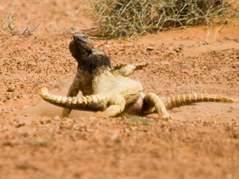
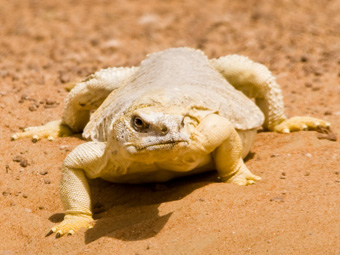
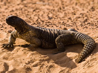
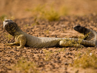
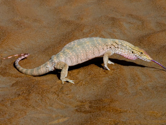
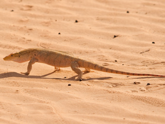
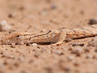
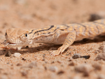
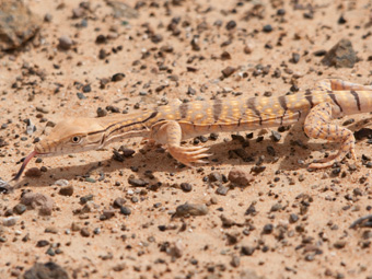
Leptiens Spiny-tailed Lizard
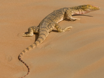
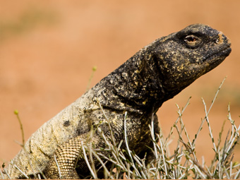
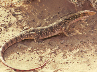
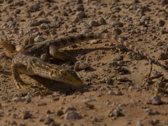
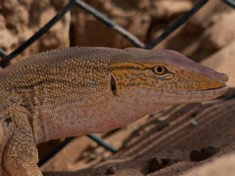
Desert Monitor
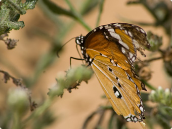
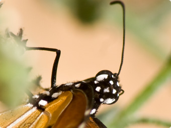
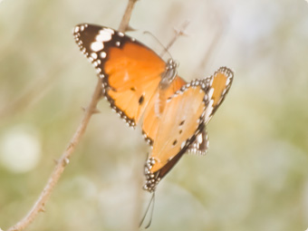
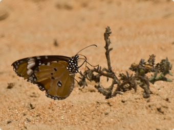
Plain Tiger
Zahar
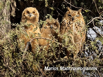
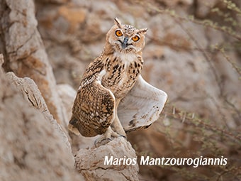
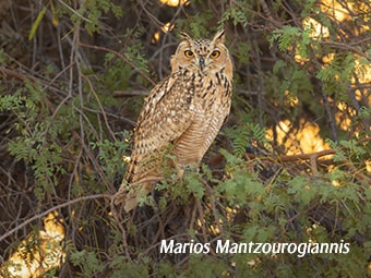
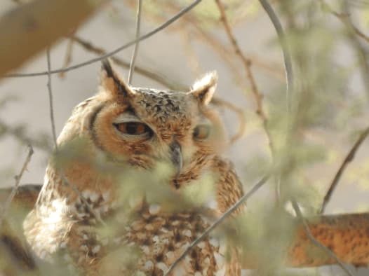
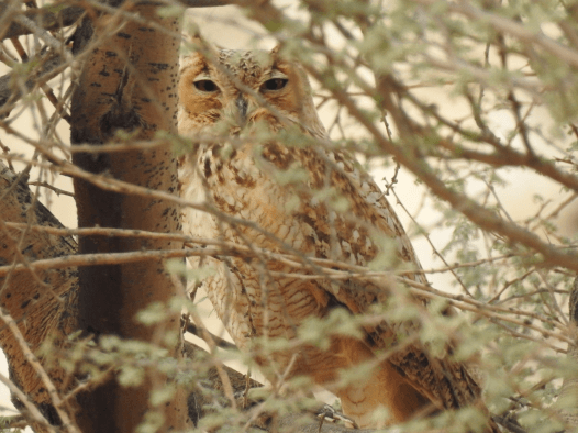
Pharaoh Eagle Owl
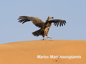
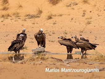
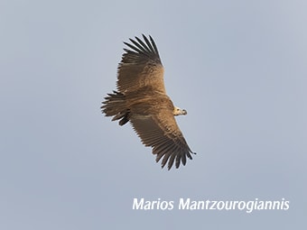
Lappet-faced Vulture


THINGS TO DO AT DDCR
Book our approved excursions and set off on an adventure in nature

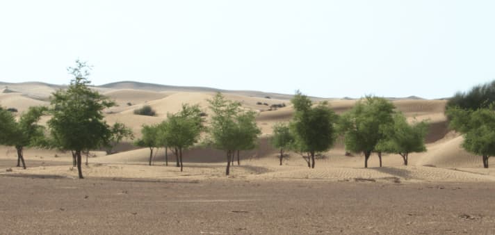
OUR RESEARCH
At DDCR, we ensure the preservation of biodiversity on the reserve through continuous data gathering and research
Monitoring Program for the Major Site Values of the DDCR
Quantitative analysis of the hyper-arid vegetation changes under grazing in Dubai Desert Conservation Reserve
Quantitative analysis of the hyper-arid vegetation changes under grazing in Dubai Desert Conservation Reserve
Aims
To implement a continuous practical and efficient vegetation monitoring program by applying analytical tools for effective data interpretations. As vegetation is the base of the food pyramid the expected data and information is indispensable for managing the ecology of the Dubai Desert Conservation Reserve.
Goals
To evaluate the current state of the DDCR vegetation, the study is focuses on the assessment of density, cover, and biodiversity of the flora in the DDCR and follows the continued monitoring and repeated vegetation studies of 2004 (El Alqamy, 2004) and 2009 (Khafaga, 2009). To present the results through the mapping of the vegetation and by defining the lineage between different floral communities, using multivariate analysis combined with GIS techniques.
Methodology
Using the plot sampling method at 302 randomly selected sites, at each site, a circular plot is adapted for sampling the vegetation with an area of 50m diameter and each plot in total is equivalent to 7850m2. (Khafaga, 2009)
Plant species in each given plot are tentatively recorded in the field and put in tabulated form, giving the authentication of their identification with the help of the floristic books.
For each species total number of individuals are counted and an average size (length x width x height) is calculated.
To achieve the goal, data interpretation will require the adoption of the following strategies:
- Floristic composition and phytosociology
- Density and Relative Density
- Abundance and Relative Abundance
- Frequency and Relative Frequency
- Cover and Relative Cover
- Important Value Index (Species Dominance).
- Diversity Indices
- Simpson Dominance Index
- Shannon Diversity Index
- Margalef Richness Index
- Spatiotemporal variation of plant communities
- The calculation of the values of the diversity indices of individual plots over different habitats will interpolate predicted variety in un-sampled areas and will produce an overall picture of how diversity is changing over the entire DDCR.
Expected outcomes
The anticipated results will encompass three main themes. These are:
- Assessing species diversity and variability of the DDCR flora.
- Comparison of floral communities in different habitats, specifically comparing the populations of Gravel Plains against those of Sand Dunes.
- Examining the vegetation diversity through various monitoring events and with altered adverse pressure and climatic factors.
Changes in functional diversity under grazing pressure in hyperarid shrubland ecosystem
Changes in functional diversity under grazing pressure in hyperarid shrubland ecosystem
Aims
To investigate the term Functional diversity “a variety of life-history traits presented by an assemblage of organisms” with regards to the vegetation diversity of DDCR. It has been postulated to be critical for the maintenance of ecosystem processes and properties.
The conceptual linkages between ecosystem disturbance, species diversity and functional diversity are fundamental to resource management and conservation planning.
Goals
To study the changes in intensity and timing of grazing and its effect on the changes in taxonomical and functional composition and subsequent changes in ecosystem functioning. These changes will explain the great interest in monitoring the impact of grazing on plant communities for the purpose of preserving their biodiversity and economic or aesthetic values.
Methodology
- Divide the reserve into three sectors (North, Centre and South).
- In each area, randomly select 25 sites for each habitat types (Gravel Plains and Sand Dunes), 150 sites in total.
- Build a matrix of different vegetation Functional traits for various monitoring times (2009 & 2017).
- Choose 24 “Functional Traits” to study the effect of grazing on vegetation and measure the response diversity in DDCR ecosystem.
- All attributes values will be recorded from published sources and herbarium information, except for the “plant heights” trait which will be measured in the field or collected from previous measured field studies.
- Anova and Diversity indices will be applied.
Expected outcomes
- A set of complete functional traits of DDCR.
- The change of the vegetation functional traits between different grazing pressures.
- A prediction of which functional character are more resilient and less vulnerable to any disturbances.
- Assessment of the changes in the diversity responses along a grazing gradient (the spatial variation of disturbance intensity).